Conquering California's Stage 3
Tour of California organiser Medalist Sports has sharpened the stage three route profile for 2008,...







Tales from the peloton, November 21, 2007
Following the announcement of the 2008 Tour of California's route last week, Cheerwine professional and area local Sarah Bamberger couldn't wait to check out the new course for Stage 3 to discover what challenges the professional men will face next February.
Tour of California organiser Medalist Sports has sharpened the stage three route profile for 2008, with the revised 152.2 kilometre stage from Modesto to San Jose to feature aromatic farmlands, steep pitches in a desolate canyon, the climb up the infamous Mt. Hamilton followed by an arduous, 20-mile descent.
Then the race goes up Sierra Road, which will further punctuate the difference between the event's contenders. For the King of the Mountain's classification this stage will present at least two opportunities for points, but not until the latter half of the stage. This first 'real' climbing stage of the 2008 event will offer the initial glimpse of which general classification riders are actually on track for the early season Hors Categorie Stage Race.
Small town start to a big stage
Although stage three ends with the familiar Sierra Road climb and finish line approach in San Jose, the remainder of the stage is entirely new. Modesto hosts the start of the day and the preparations are already in effect. I know how exciting it is to race in a huge city that makes you feel important - San Francisco, Philadelphia, Minneapolis - but when a massive event like California comes to a relatively small town, the impact is even greater on the community. As racers you can't really get a better shot at feeling larger than life.
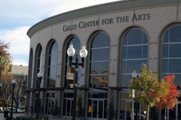
Modesto is a central valley farming community that has been revamped in recent years to showcase the contributions of some of its people. Star Wars director George Lucas was born here and immortalized the town with another of his films American Graffiti. E. & J.Gallo Winery is headquartered here and the race starts adjacent the brand new Gallo Center for the Performing Arts. Modesto still has an old fashion drive in - the A&W Restaurant on G Street - which is especially important for the foreign riders to visit, as it still employs carhops on roller skates to deliver the burgers and shakes.
Get The Leadout Newsletter
The latest race content, interviews, features, reviews and expert buying guides, direct to your inbox!
The communities cycling population might be small, but it's incredibly active in persuading many local city organisations to support the event. Modesto is looking to make an impression during the Tour - they even have a suggestion box on the City's homepage.
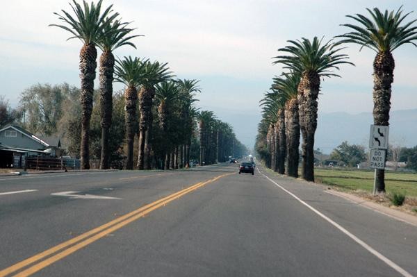
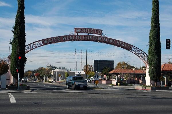
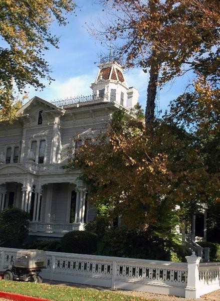
Stage three starts with two parade laps around downtown, past the McHenry Mansion and Museum and then under the Arch, erected in 1912, where the race then goes south. After passing Modesto High School and a middle school, the actual race starts where the town's border meets farmland. As the caravan approaches Highway 5 - the main interstate that vertically bisects California - the race travels along a newly developed stretch toward Patterson. Hundreds of Palm Trees line this corridor, giving indication of the eastbound headwinds. If any racers take too long a swig from their bottle, they may miss the town of Patterson altogether, except for the rowdy school children expected to line the route.
Into the wild
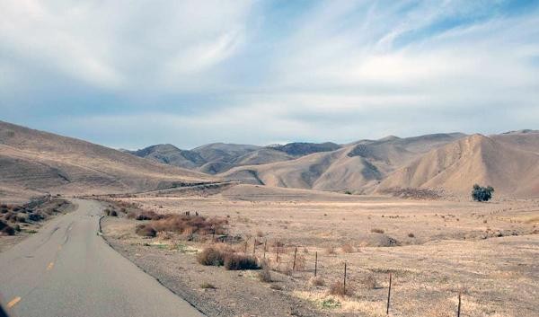
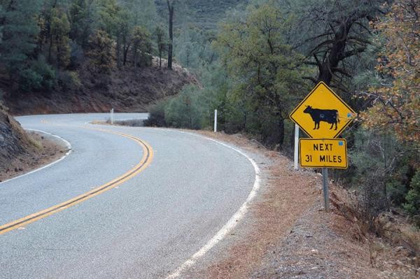
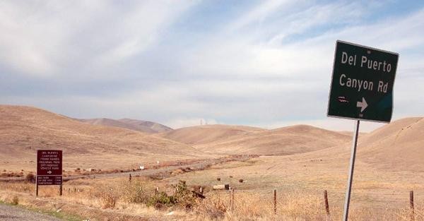
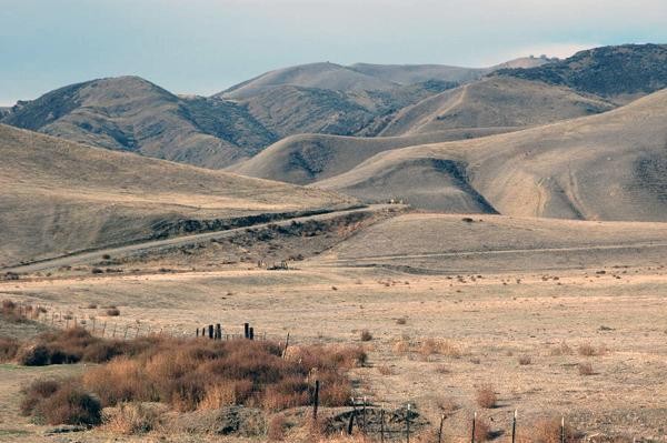
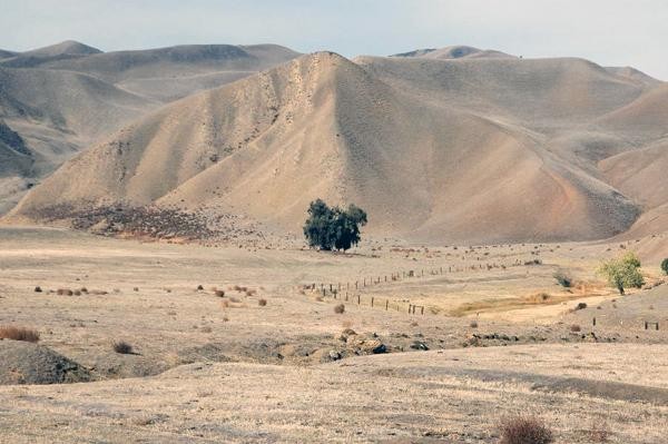
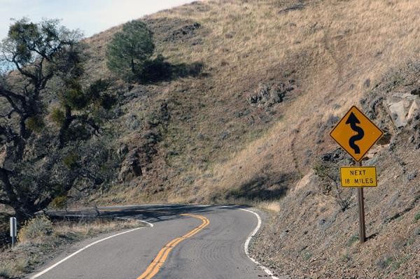
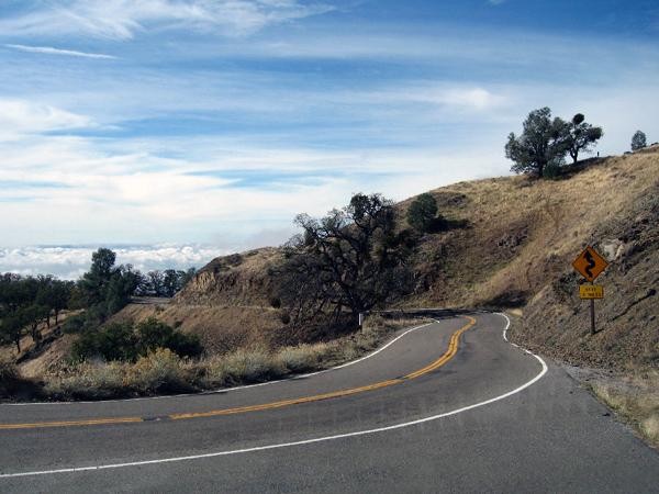
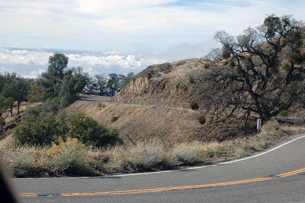
Leaving all signs of civilization behind, the course goes up Del Puerto Canyon and begins an unremitting, serpentine ascent through an open cattle range for about 72 kilometres. Del Puerto Canyon Road carves deep into the furrowed canyon for kilometers, with gorgeous rocks and trees providing a scenic route. Since the wind usually blows in a northwesterly direction, the field will experience a tailwind.
There is an occasional flat stretch, but no more than a kilometre here or there, with elevation gain at 4000 feet (1200m). Most of the approach to Mt Hamilton is grades of two-five percent, but there are three points where for a few kilometres the road pitches up to 12-15 percent. The first of these heartbreakers is known as 'The Wall', about 32 kilometres into the canyon. Every cyclist knows what this means and it will be especially heartbreaking for the peloton on February 20 because there is little relief afterward. These short but painful climbs will attenuate the mind as well as the legs and all efforts in the canyon should be meaningfully exerted.
Due to the twists and switchbacks of the canyon, some teams will sacrifice a rider or two on this portion of the course and find that a small group will have good odds of staying away before the main climb. This classic maneuver to help take pressure off the general classification teams may be more fruitful than other courses due to the epic descent from the top of Mt. Hamilton. The sacrificial lambs have to make it to the top first, of course, but providing they do, it could produce some breakthrough results for those guys who are becoming better climbers but are there to support the general classification riders.
The lack of visibility, coupled with the major climbing at the second half of the stage, means many teams will allow a non-threatening group to get ahead and figure the course will bring them back. Even if a bunch does stay away, there are more mountainous days ahead for contenders to regain time.
At about kilometre 72 the terrain opens up temporarily. The San Antonio Junction Café marks the point where the race goes left toward Mt. Hamilton. If the weather signals a chance of snow or ice on Mt Hamilton, the race will instead go right up Mines Road and visit Livermore before hitting Sierra Road.
The beast itself
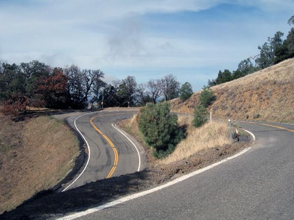
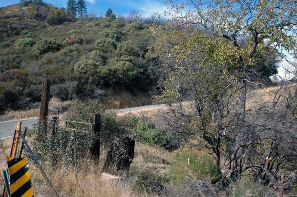
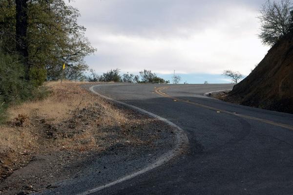
The monstrous Mt. Hamilton takes centre stage in the 2008 route, with a solid 11 kilometre ascent which begins at kilometer 93 of the race. There are several vantage points along the ascent that include tight switchbacks and epic vistas - possibly of the Sierra Nevada Range if the skies are clear enough. When you can stand on the top portion of a switchback and look straight down to the road below you know it is steep. The initial five kilometres of the climb rise up between 5-10 percent, with a few hairpins at 11-13 percent. This is the harder half and a great point for attacks to start.
The extreme twistiness of the road means that if someone gets a gap of five-seven seconds they will virtually be out of sight. Expect a fight amongst the riders seeking the polka dot jersey, further upping the pace toward the peak. As a spectator you can find a natural spring at kilometre five, which is also where the climb eases slightly but still averages seven-eight percent. However the climb is arduous and the fans that line this route will likely see the shape of the race unfold right in front of them.
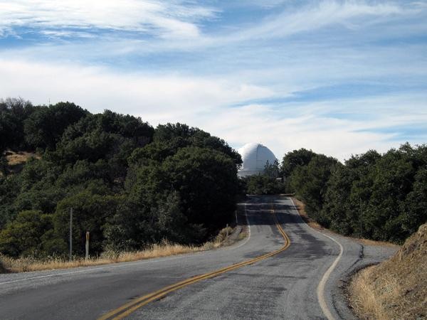
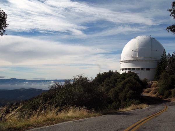
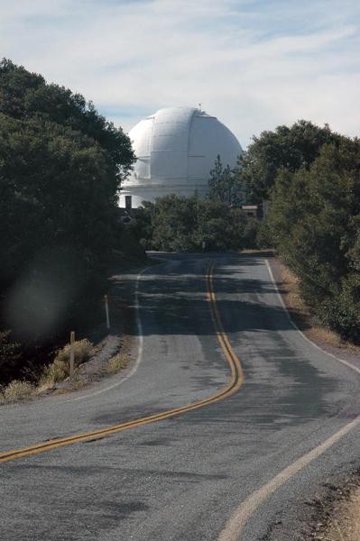
Approaching the top, the racers will experience a flat-ish road that leads to a big white dome. This is significant because this stretch provides the only long distance view of just how far off the next group is, by about 15-20 seconds. The summit is characterized by these white and silver domes - home of the Lick Observatory. While fans wait for the race, they can view UFOs or the race helicopter through one of the telescopes. Clif bar junkies might also be interested to know that at this point in the route, back in 1990, company founder Gary Erickson had his epiphany to start Clif Bar.
The descent off Mt. Hamilton is one that local pro Ben Jacques-Maynes knows well, and for this reason he has a big advantage. On the descent, there are 13 tight switchbacks in 11 kilometres until the race reaches Grant Ranch Park. At this point there is an uphill gain of 300 feet (90m) over almost three kilometres, followed by a downhill for 9.5 more kilometres. Overall the grade averages 4.7 percent, which, over 25 kilometres, is a lot of elevation lost.
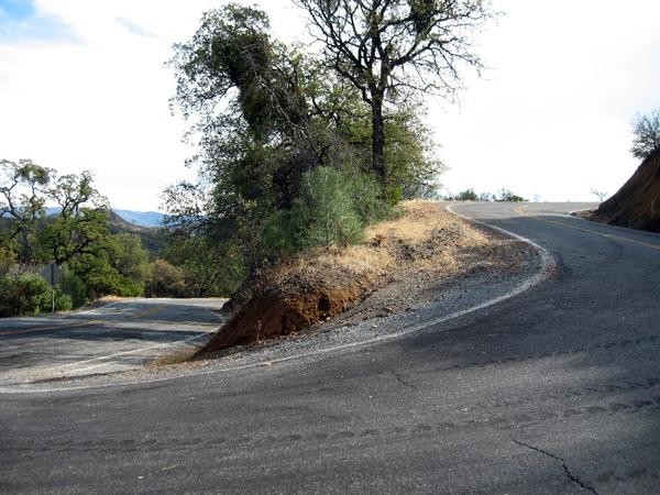
The tight, downhill switchbacks and narrowness of the road will require a lot of concentration and courage. Some of the turns are so steep that you could practically lean over from one switchback and spit on the one below [although we don't recommend spectators try - Ed.]. If there is a gap someone is trying to bridge, they may be smarter to wait for the two short climbs that break up the 30 kilometre descent into San Jose to make the move. Otherwise, there is very little flat road between the base of Mt. Hamilton and the base of Sierra Road to bridge a gap.
With so much potential for drama even before Sierra Road, Mt. Hamilton will likely draw more spectators. In terms of riding the stage before the caravan comes through, it is 37 kilometres from the base of Mt. Hamilton on the west side to the midway point on the east side of the mountain. This makes for a great day on the bike; challenging terrain, but extremely rewarding with views of the entire Bay Area and beyond. Plus the hard part is accomplished in the beginning.
Onto familiar roads
Once at the bottom, the racers' legs will be jarred back into climbing again only a handful of kilometres later. This last ascent of the day, Sierra Road, is well respected as one of the hardest climbs in the Tour. Although it follows a tough act in Mt. Hamilton, Sierra Road can do its own damage with its torturous gradient of 9.5 percent over 3.5 miles (5.6 km).
Whoever is left together on Sierra will use this as the last chance to blow each other up and the pressure will be on as this peak includes another KOM line. Last year, Levi Leipheimer (Discovery Channel) pulled Chris Horner (Predictor-Lotto) up to the winning break, but as newly minted Astana team-mates we could see a more dominating effort from them earlier in the day. This climb will be excruciating for the great climbers and simply inhumane to the rest; and the time gaps at the finish will reflect the difficulty of this last 29 kilometres.
San Jose has been thrice blessed with the stage finish in front of City Hall. With over 8300ft (2500m) of climbing covered, there will only be small groups of racers finishing together over a long period of time. With some planning and luck, a spectator might be able to watch the Mt. Hamilton summit, and still make it to the finish line in San Jose. More realistically, the caravan will keep you from descending fast enough and therefore you would likely miss the finish.
The terrain from Modesto to San Jose is testament to the diversity in Northern California; rural lands, desert like expanses, hearty canyons with wild boar and high peaks worthy of occasional snow. There are three local road races and many rides that use portions of California's stage three route, so no matter who wins or comes in with the red lantern there will plenty of supporters who can appreciate (or sympathize with) the efforts and bravery of the racers.